Tern Bank is a naturally accreting sandbar extending from the Safety Bay Foreshore. It got its name from the Fairy Terns which nest on the bank, typically in the warmer months of November and December.
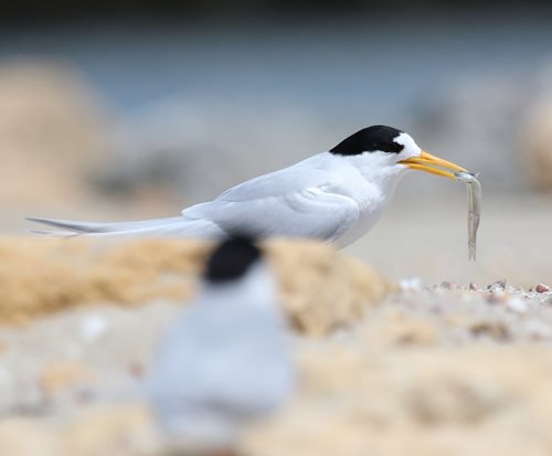
Fairy Tern feeding on Tern Bank
Sediment sources for the formation of Tern Bank are still uncertain with limited studies conducted on the potential sediment transport pathways.
The sandbar typically experiences rapid growth over the winter months with prevailing north to northwesterly winds, and remains relatively stable over the summer period with the prevailing southeasterly wind.
Tern Bank falls within the Shoalwater Islands Marine Park and is managed by the Department of Biodiversity, Conservation and Attractions (DBCA). Under an agreement between the City and the DBCA, the City manages the body of water between Tern Bank and the Safety Bay Foreshore (the Pond) and the Bent Street boat ramp navigation channel footprint.
The City conducts bi-annual coastal monitoring profiles at several key locations within the City, including Tern Bank, the Bent Street Navigation Channel and the Safety Bay Foreshore. Monitoring is conducted prior to, and after the winter season to determine the volumes of sand that have accreted over the winter period and to determine the best actions for management of Tern Bank.
The Bent Street Navigation Channel and the Tern Bank sandbar are managed through a combination of land-based excavation and dredging using a cutter suction dredge. The City has approval from the DBCA to remove 40,000m3 biennially from the area. Excavation of Tern Bank typically occurs annually, dredging of the Navigation Channel occurs less frequently, typically within a 3-5 year period, or as required to maintain a navigable depth.
Tern Bank currently provides sheltered waters for recreational activities including kite surfing and boat launching. Continued accretion of the sand bank could result in the eastern end of the sandbar reaching the Safety Bay Foreshore and thus closure of the Pond. This will impact recreational activities and also prevent natural water circulation and flushing.
Sand inundation into the Bent Street Boat Ramp Navigation Channel reduces the depth of the channel creating navigational safety hazards. Civil works must be undertaken to maintain the channel to its operational requirements. Current requirements for the Bent Street Boat Ramp consider the following:
- advice from studies conducted by the Department of Transport, boat ownership within the City and its predicted to increase, placing additional demand of the City’s boat launching facilities.
- strategies from the Shoalwater Islands Marine Park Management Plan for maintaining several key social values of the Marine Park which include ensuring equitable access to suitable areas of the Marine Park. Currently, Bent Street Boat Ramp is the only concrete boat ramp providing direct access to Warnbro Sound.
Sand accretion and growth of Tern Bank is expected to continue. The rate at which this occurs will be determine by weather patterns, in particular the frequency and strength of winter storm events. Future management of Tern Bank falls under the City’s Community Plan and associated strategies.
The City’s Coastal Hazard Risk Management and Adaption Plan (CHRMAP) has identified several areas worth further investigation, including detailed sediment transport analysis studies. These studies will be used to determine the best course of action for managing the City’s coastline and associated coastal facilities including Tern Bank and the Bent Street Boat Ramp.
The City’s Coastal Facilities Strategy has identified the development of a Strategic Boating Provisions Plan (SBPP) as an key action. The SBPP will deliver recommendations for the upgrade/downgrade of existing boating facilities and/or identification of new locations for meeting future demand with consideration of future boating demands, the Shoalwater Islands Marine Park Management Plan and sediment transport pathways.