In our extensive waterways, a boat is a fantastic way to experience the best Rockingham has to offer.
There are many recreational boat launching facilities along the Rockingham coast, as well as public jetties, courtesy boat moorings and excellent beach fishing locations.
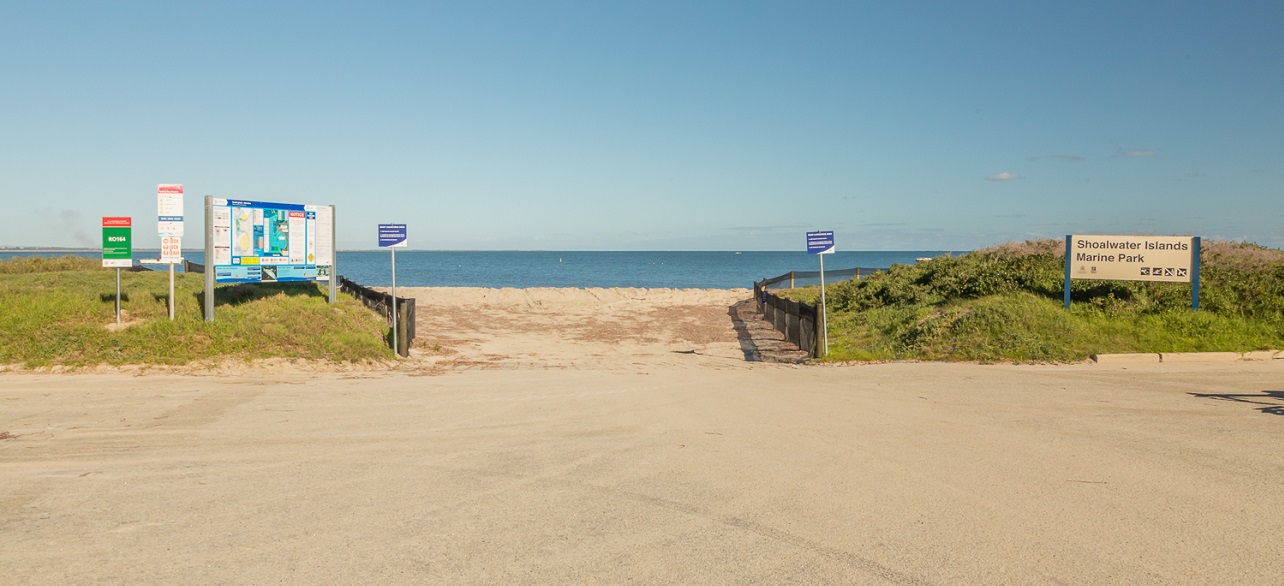
Some areas of the Shoalwater Island Marine Park, particularly the Sanctuary Zones are off limits to recreational fishing and boating.
Fishing
For information regarding demersal fishing and crabbing seasons in local waters, size limits and other restrictions visit the Department of Fisheries.
Shark Fishing
The State Government has legislated that as of 3 November 2023, shark fishing is banned within 800m off shore from Tim's Thicket to 5km north of Two Rocks Marina including all waters of the Swan-Canning Estuary. This includes the City of Rockingham.
The restrictions have been introduced to address community concerns for public safety.
Department of Primary Industries and Regional Development compliance officers will be ensuring fishers adhere to the new wire trace restrictions, and existing bans on the use of burley comprising mammal or bird products, such as blood and offal.
Anyone who observes suspicious fishing activity in Western Australian waters can report this to FishWatch 1800 815 507 or through an online form on Crime Stoppers.
Report a shark sighting
All shark sightings must be reported to Water Police on 9442 8600.
Boat safety
Log your proposed boating journey with Marine Rescue Rockinghamopens in a new window and update your log if your plans change to ensure that someone knows your whereabouts at all times, and in case a search has to be organised if you fail to return.
Log on/Log off using VHF CH 72
Take note of your local network of Beach Emergency Network Signs (BEN signs)opens in a new window. The signs are used to match emergency services and improve response times to your location should there be an emergency.
Find out about safety equipment for your boat, such as anchors, bailers or bilge pumps, emergency position indicating radio beacons (EPIRBs), flares, fire extinguishers, radios and life jackets.
Jetties
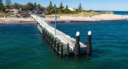
Mersey Point Jetty
Mersey Point Jetty is located on Arcadia Drive in Shoalwater. The jetty is used both recreationally and commercially.
Mersey Point Jetty has car parking facilities available, including larger spaces for buses.
Fishing is permitted from jetty, however users are asked to respect the commercial jetty operators during berthing.
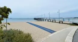
Palm Beach Jetty
Palm Beach Jetty is located on the Esplanade opposite Fisher Street in Rockingham.
There is on-street car parking facilities available along the Esplanade.
Fishing is permitted on this jetty.
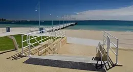
Val Street Jetty
This jetty is located in the heart of Rockingham Foreshore opposite The Cruising Yacht Club on Val Street.
This is a recreationally used jetty with short term berthing available to boat users.
Val Street Jetty also has a low level landing available for fishing.
Boat launching facilities
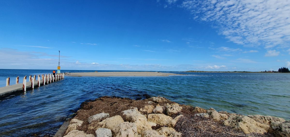
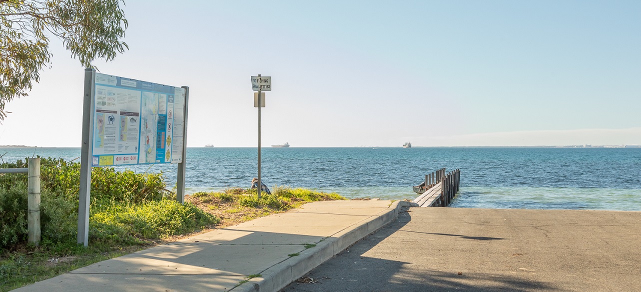
Bent Street Boat Ramp is located on Safety Bay Road, opposite Bent Street, Safety Bay. The boat launching facility consists of two formal concrete boat launching and retrieval ramps associated with a central holding jetty. Due to the significant ongoing sand accretion at the head of Tern Bank Sandbar, the Bent Street Boat Launching Facility has been closed to the recreational boating community. Overtime, the strategies used to manage Tern Bank sediment have become more difficult to maintain, due to the rapid growth of the sandbar and the increased cost to the City to manage the sand accretion in recent years.
Currently, the boat launching facility has 23 formal boat trailer parking bays available, 10 standard car parking bays and one ACROD Bay. The facility also includes an informal overflow grass parking area to the west of the facility. With the closure of the boat ramp, the car park configuration and future use is under review by the City.
Temporary Notice to Mariners
During spring 2025, the Department of Transport (DoT) Navigational Safety Division will commence removal of the navigation aids located 300m south of the boat ramp that demarcate the deep water entrance/exit to the former Bent St Boat Ramp Navigation Channel. Marine safety signage also located at Bent Street Boat Ramp will be decommissioned by DoT.
No Dredging at Bent Street and Tern Bank in 2024
At its Ordinary meeting on 24 September 2024 Council resolved to decline all tenders for Tender T24/25-65 - Provision of Services to Extract Sand from the Bent Street Boat Ramp Navigation Channel and Tern Bank Sandbar.
For more information please read the FAQs below.
Frequently Asked Questions: Sand Build-up at Tern Bank in Warnbro Sound
Why does sand continue to build up at Tern Bank?
The build-up of sand at Tern Bank is a natural coastal process. Over time, sand is transported by waves and currents from the outside the Murray Reefs system (aka Five Fathom Bank) to the northern shoreline of Safety Bay.
Tern Bank is a sedimentary rapidly evolving and growing feature, progressing from a small, narrow submerged bank shoal to an extensive alongshore sand spit. Tern Bank's development is significantly influenced by offshore sediment sources and seasonal wave activity, leading to alternating periods of rapid growth and stabilisation. Tern Bank has been gradually migrating eastward, influencing local beach profiles and posing challenges for navigation and beach access.
What is being done to understand this phenomenon?
In 2024/2025, the City of Rockingham engaged a specialist coastal processes modelling consultant to conduct an investigation into the unique coastal processes of accretion and erosion in northern Warnbro Sound. This study reviewed the sand build-up at Tern Bank and the outcomes are available in the related documents below.
The modelling results indicate that, over the long term and irrespective of management interventions, the spit will degrade, the Pond will infill, and sediment from Tern Bank will redistribute along the northern shoreline of Warnbro Sound—ultimately smothering the Bent Street Boat Ramp.
Why are the Bent Street Boat Ramp Facility’s ramp lanes closed off?
Due to the build-up of sand at Tern Bank predominantly over winter 2025, the water depth has reduced. This has created safety concerns about the interaction between boats and patrons swimming or recreating at the edge of the Tern Bank sandbar.
Given the projected evolution of Tern Bank and in line with the recommendations of the modelling report, the City has resolved to remove or repurpose the Bent Street Boat Ramp, allowing natural coastal processes to proceed unimpeded at that location.
Are there alternative boat ramps that I can use nearby?
Yes - the City has alternative concrete boat ramp lanes with vessel holding jetties available at Port Kennedy, Point Peron, and Palm Beach. Carlisle Street and Donald Drive over-sand boat ramps are available for the launching and retrieval of smaller trailered vessels with four-wheel drive vehicles.
Which part of the coast is within the City of Rockingham’s management jurisdiction?
The City’s jurisdiction ends on land at the high water mark. However, the City is currently responsible for the Bent Street Boat Ramp and associated infrastructure.
Tern Bank Sand Bar is a gazetted Nature Reserve managed by Department of Biodiversity, Conservation and Attractions (DBCA).
The associated water body, known as The Pond, falls within the General Use Zone of the Shoalwater Islands Marine Park and is also managed by Department of Biodiversity, Conservation and Attractions (DBCA), Swan Coastal District.
What is being done to maintain the water quality within The Pond?
The Shoalwater Islands Marine Park is managed by the Department of Biodiversity Conservation and Attractions. The Department of Health oversees a water quality monitoring program to ensure recreational waters are safe for recreational use. This monitoring program is conducted across Western Australia in conjunction with local governments which collect water samples on behalf of the Department of Health.
If the monitoring results indicate that the water fails to meet the recreational water quality guidelines, then the area will be closed for recreational water use until the water quality returns to a satisfactory level.
Has Water Corporation been contacted about its drain into the Pond and its responsibilities regarding water quality?
The City is in discussions with Water Corporation about its future plan for the stormwater outlet. While Water Corporation has upgraded and increased capacity at the Forrester Road basin in recent years, it has not advised the City about any plan for the stormwater outlet at The Pond. The capacity increase at the basin means a lower volume of water is entering The Pond through the drain than before. If you wish to discuss this matter further, please contact Water Corporation directly.
Who do we contact if we have concerns about water quality?
The City will continue to test The Pond every fortnight to ensure it is safe for recreational use. Concerns about the quality of the water in The Pond can be directed to the City’s Health Services on 9528 0333 or via customer@rockingham.wa.gov.au.
What is the long term plan for the management of The Pond?
The Pond is located within the Shoalwater Islands Marine Park (SIMP). The Department of Biodiversity Conservation and Attraction (DBCA) is responsible for the management of the marine park and is guided by the Shoalwater Islands Marine Park Management Plan. The Plan refers to water quality in a number of sections to achieve the vision of the marine park. Therefore, DBCA will be the lead agency in regards to the long-term Pond management. Please refer your enquiries to wanneroo@dbca.wa.gov.au.
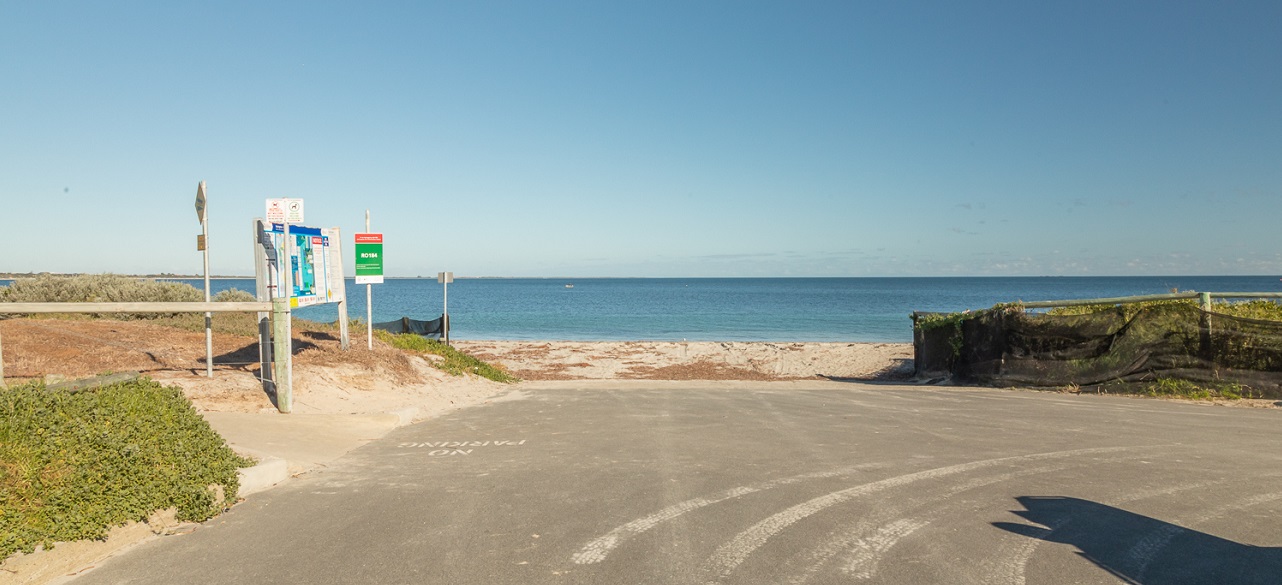
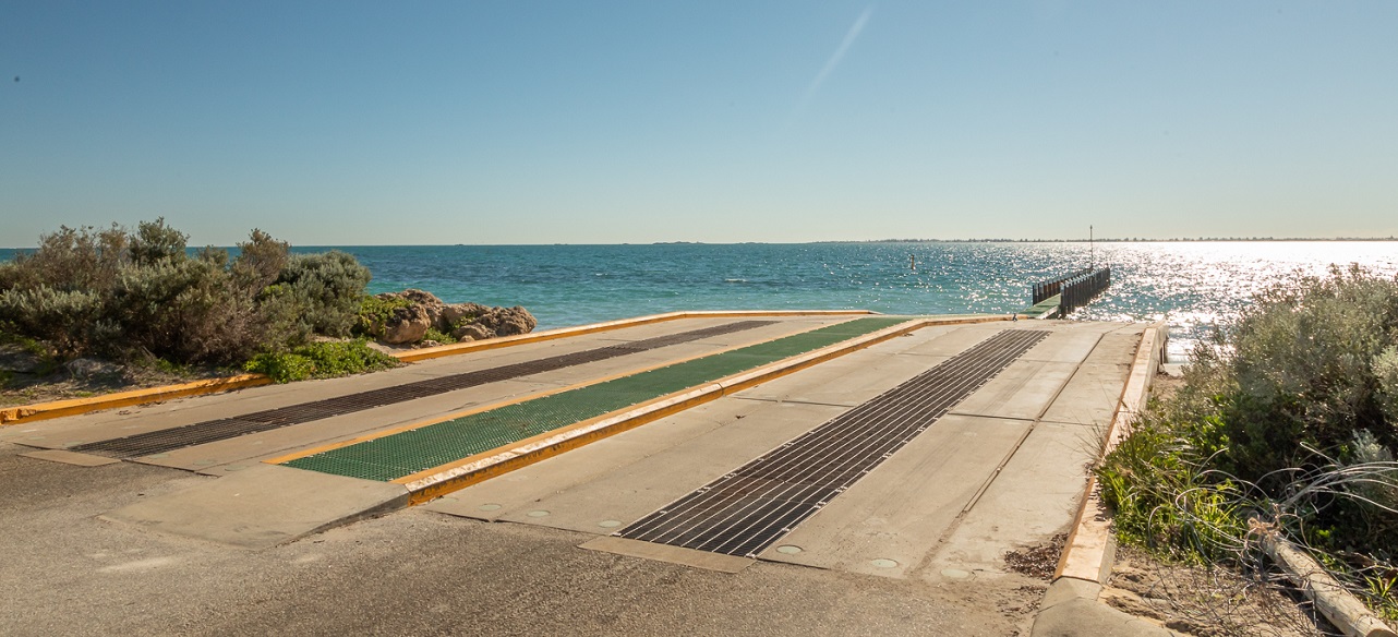
Carlisle Street Boat Ramp is located on Arcadia Drive opposite Carlisle Street in Safety Bay.
This is a sand launching facility and has approximately 12 boat trailer parking bays available.
Donald Drive Boat Ramp is located on Safety Bay Road opposite Donald Drive in Safety Bay.
This is a sand launching facility and has approximately 15 boat trailer parking bays available.
Palm Beach Boat Ramp East is located in Rockingham and allows boat users to launch their vessels into Cockburn Sound.
There are two ramps and one holding jetty available for use.
Boat trailer parking is available by Palm Beach Boat Ramp West and car parking is available along the Esplanade.
Palm Beach Boat Ramp West is located in Rockingham and allows boat users to launch their vessels into Cockburn Sound.
There is one ramp and one holding jetty available for use.
Boat trailer parking and car parking is available at this facility and along the Esplanade.
Point Peron Boat Launching Facility is located on Point Peron Road.
This facility has six ramps and three holding jetties available for use.
There is a large amount of boat trailer parking at this facility.
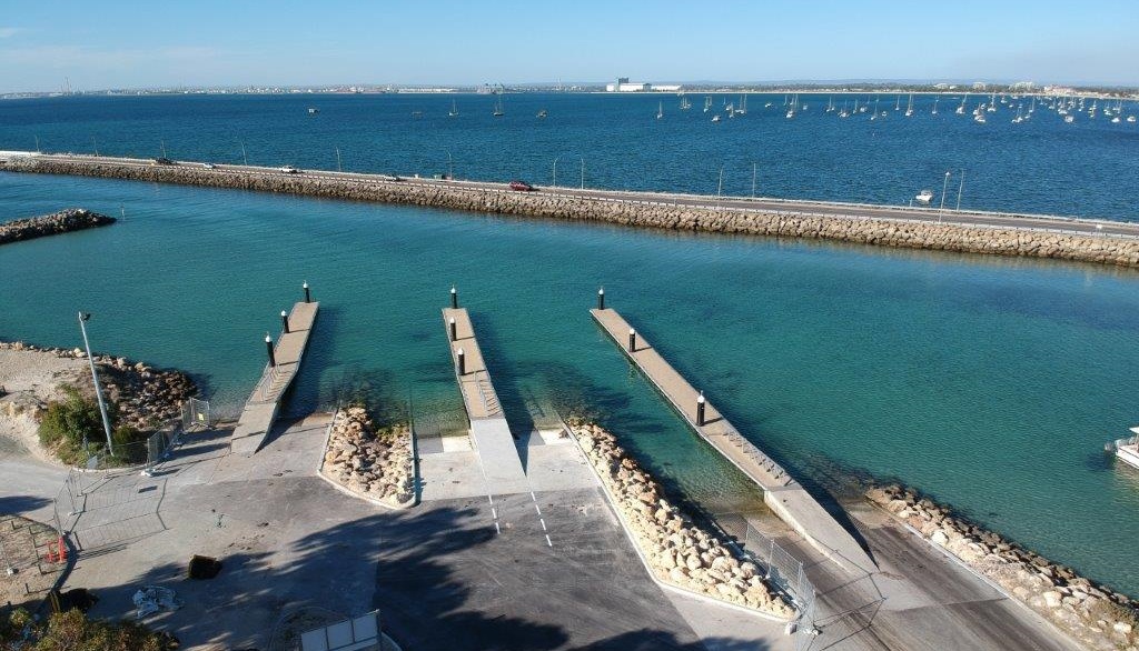
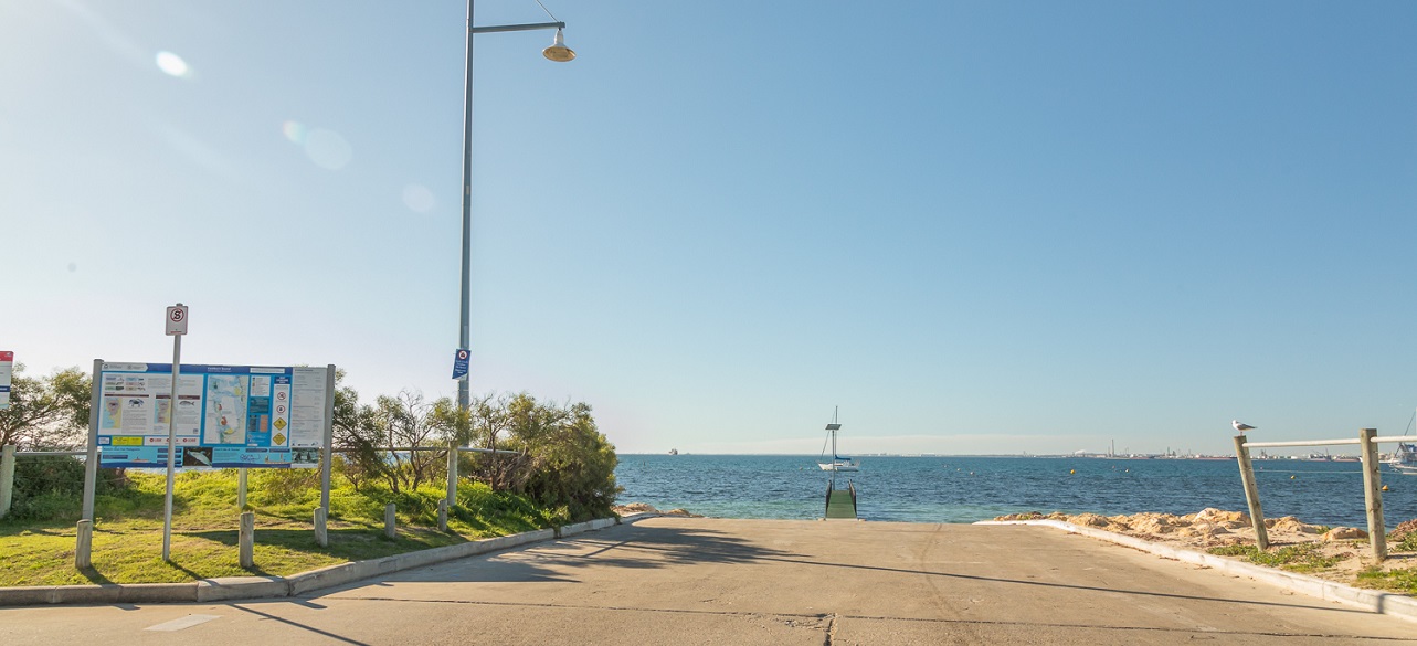
Port Kennedy Boat Launching Facility is located on Port Kennedy Drive.
This facility has two ramps and one holding jetty.
Boat trailer parking, public toilets, barbeques and picnic benches available for use.
Frequently asked questions
Mooring enquiries for Mangles Bay can be made to the Department of Transport Marine Safety on 9435 7500 or navigational.safety@transport.wa.gov.au. Mooring enquiries for Safety Bay can be made to the Department of Biodiversity, Conservation and Attractions – Swan Coastal District on 9303 7700.
Please contact the Department of Transport Marine Safety on 9435 7500 or navigational.safety@transport.wa.gov.au.
Please contact our Coastal Engineering Officer via email on customer@rockingham.wa.gov.au.
Please contact the Department of Transport Marine Safety on 9435 7500 or via email to navigational.safety@transport.wa.gov.au.
Please contact our Coastal Engineering Officer via email on customer@rockingham.wa.gov.au.
Visit the Department of Transport website for the latest updates: