
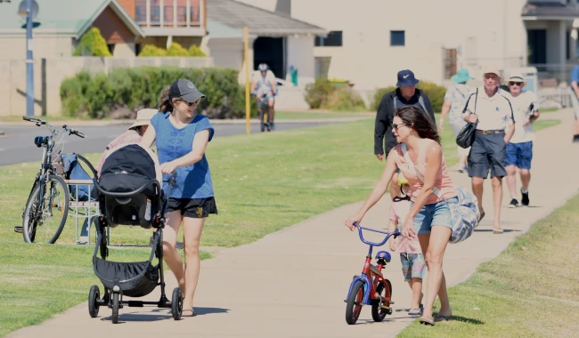
As part of the Long Term Cycle Network Plan, we're planning to install new footpaths at various locations across the City.
These projects aim to improve the safety for pedestrians and cyclists, making it safer and easier for people to walk, ride and move around the area ensuring pedestrians no longer need to walk on verges or the roadway.
The upgrades also support the goals of our Road Safety Action Plan.
Share Your Thoughts
Proposed footpath works open for comment
Community feedback is essential to help us shape the final designs before construction begins.
Details of each proposed footpath location and their associated works can be found below, then use the form to share your thoughts.
The City is planning to install a footpath between Rae Road and Georgetown Drive.
The footpath will:
- Establish an alternate link between Rae Road and Georgetown Drive.
- Enhance accessibility for residents and function as an additional pathway for students attending Safety Bay Senior High School.
- Improve connections to existing walking paths, making it easier to access bus stops on Acapulco Road, as well as Bequia Reserve and Madeira Park.
View the plan for Port Royal Drive here (PDF)
Open for comment: 14 September 2026 - 2 October 2026
The City is planning to install a footpath between Clearwater Way and Harmony Parade.
The footpath will:
- Establish a missing link between Clearwater Way and Harmony Parade, thereby enhancing the footpath network connectivity and pedestrian safety.
- Offer a safer route for students to Singleton Primary School and improve access to nearby Harmony Park for residents.
- Enhance accessibility, particularly for older adults residing at nearby aged care facilities.
View the plan for Reeds Avenue here (PDF)
Open for comment: 14 September 2026 - 2 October 2026
Proposed footpath works
Thank you to everyone who provided feedback. The consultation period has now closed and the project team is reviewing submissions. We will provide an update on the project shortly.
The City is planning to install a footpath on La Manche Avenue between Chelmsford Avenue and the existing internal road of Stargate Shopping Centre, Port Kennedy.
The footpath will:
- Provide the missing link between existing footpaths adjacent to the commercial centre, improving accessibility and universal access to shopping.
- Serve as part of the overall pathway network to Port Kennedy Primary School and St Bernadette’s Catholic Primary School, physically separating children from the active vehicle lane and reducing accident risks.
- Encourage regular walking and cycling to nearby reserves, promoting healthier lifestyles and the well-being of residents.
Open for comment: 17-28 August 2026
The City is planning to install a footpath between Harrington Waters Drive and Arnside Bend, Waikiki.
The proposed footpath will:
- Provide a missing link between existing paths on Harrington Waters Drive and Arnside Bend, thereby complementing the overall pathway network.
- Improve connectivity to nearby schools (South Coast Baptist College and Waikiki Primary School), supporting safe travel on footpaths rather than on the road or verge.
- Provide safe, convenient and comfortable pedestrian and cycling connections within the footpath network to nearby reserves, such as Harrington Waters Reserve and Santa Monica Reserve, to support recreation and social interaction.
Open for comment: 17-28 August 2026
The City is planning to install this footpath between Burnsville Drive and Newfound Street, Secret Harbour
The footpath will:
- Provide a connection to Comet Bay Primary School on Burnsville Drive and improve walking and cycling access to Comet Bay College on Allatoona Avenue, supporting safe and convenient travel for students of all ages.
- Complete the gap between the existing paths on Burnsville Dr and Bluestone Pkwy, integrating Lowell Street into the broader local pathway to enhance overall neighbourhood connectivity, particularly to the commercial centre at Warnbro Sound Ave.
- Provide a safer alternative route to nearby recreational areas, including Nottely Crescent Reserve and the golf course, lowering the barrier to healthy daily habits such as walking, jogging, or cycling for residents and encouraging active recreation.
Open for comment: 17 August 2026 - 11 September 2026
Scheduled footpath works
Footpath works are scheduled or underway at the following locations. Expand the tab to see what project stage a location is in. Details including location and any applicable detour plans are included below.
We are installing a 2m wide concrete footpath between Read Street and Varley Crescent in Cooloongup.
This footpath will:
- Create a link between Varley Crescent and Read Street, improving connectivity between residential areas on the west and east sides of Read Street.
- Improve access to the Malibu Market, Malibu School, Safety Bay Senior High School, and surrounding reserves.
- Provide a direct connection to bus stops on Read Street.
- Support safe pedestrian and cyclist movement, particularly during school peak periods.
Scope of works
- Demolition works.
- Concrete footpath works.
- Crossover reinstatement's.
Traffic management details
- During construction the road will be under traffic management.
- Delays can be expected during this period.
- Residents will have access to their properties at all times.
Project timeline
Works are anticipated to commence November 2026 and be completed by end November 2026.
We are installing a 2 metre wide concrete footpath between Millgrove Avenue and Goongarrie Drive, Cooloongup.
The footpath will:
- Provide a direct, accessible link between the existing footpaths on Millgrove Avenue and Belrose Crescent.
- Strengthen continuity within the local footpath network, particularly for school students and residents walking toward Willmott Drive and surrounding streets.
- Improve connections to Cooloongup and East Waikiki Primary Schools, Alf Powell Reserve, Cooloongup Skate Park, and Hourglass Reserve.
Scope of works
- Demolition works.
- Concrete footpath works.
- Reinstatement works including verges, crossovers, irrigation and landscaping if required.
Traffic management
- Temporary traffic management will be in place to assist road users and residents ensuring access and safety. This may include one‑way traffic arrangements or stop/slow control as required.
- Resident will have access to their properties at all times.
Project timeline
Works are scheduled to commence late November and be completed in December 2026.
We are installing a concrete footpath along Palmer Street, Warnbro between McCormick Street and Fendam Street.
The footpath will:
- Form part of the East–West pedestrian route to the foreshore.
- Enhance walking and cycling access to nearby schools, including Warnbro Primary School, Warnbro Community High School Education and Living Waters Lutheran College.
- Improve access to key community destinations such as the Warnbro Community Library, Warnbro Centre, and local facilities including churches, Aqua Jetty, Warnbro Beach, and neighbourhood parks.
Scope of works
- Demolition works.
- Concrete footpath works.
- Install of limestone wall.
- Crossover reinstatement's.
Traffic management details
- Traffic management will be in place to assist road users during the works. This may include one-way traffic arrangements or stop/ slow as required.
- Residents will have access to their properties at all times.
Project timeline
Works are scheduled to commence early October 2026 and be completed in October 2026.
The City is planning to install a new 2.5 metre wide concrete pedestrian crossing between Mariposa Boulevard and Anstey Road in Secret Harbour.
This upgraded footpath connection will improve pedestrian safety by providing a safer and more convenient road crossing for residents and school children. The new cut-through will make it easier for young children, parents with prams, and visitors to cross during busy traffic periods. Overall, the project will create a more accessible crossing point, enhance community safety, and improve the pedestrian experience.
Works are expected to commence during September 2026 with anticipated completion October 2026.
Traffic management
- Traffic management will be in place to assist road users.
- Residents will always have access to their properties.
The City apologises for the upcoming traffic switches on Anstey Road, Secret Harbour. These changes are necessary due to construction requirements, and we have planned the works to ensure at least one direction of traffic remains open at all times to reduce impacts on the community. Thank you for your understanding.
Road closures and detour information
Date | Activities | Road closure | Detour Plan |
|---|---|---|---|
29 September 2026 to 1 October 2026 | Demolition and concrete works | East bound | Refer to Detour Plan 1 |
2 October 2026 and 5 October 2026 | Demolition and concrete works | West bound | Refer to Detour Plan 2 |
6 October 2026 | Footpath works | East bound | Refer to Detour Plan 1 |
7 October 2026 | Footpath works | West bound | Refer to Detour Plan 2 |
9 October 2026 | Back filling works | East bound | Refer to Detour Plan 1 |
Detour Plan 1 - Anstey Road and Mariposa Boulevard Secret Harbour
Detour Plan 2 - Anstey Road and Mariposa Boulevard Secret Harbour
Notice: Zero Tolerance for Abusive and Anti-Social Behaviour
The City of Rockingham is committed to providing a safe and respectful environment for our staff, contractors and the wider community.
Abusive, aggressive or threatening behaviour towards City staff or contractors, whether in person, over the phone or in writing, will not be tolerated.
Any such behaviour will result in further action as appropriate. We thank you in advance for treating our staff with courtesy and respect.
